Real-time access to Antarctic tide data.

14/07/2020

One of the most important challenges, when designing monitoring facilities in remote locations, is resilience. Remote tide gauge systems operate in extremely harsh environments and require robust communications systems that almost never fail and are capable of storing large amounts of data locally as an extra protection for data. Scientists from the National Oceanography Centre (NOC) are therefore upgrading the South Atlantic Tide Gauge Network (SATGN) to include the latest low power dataloggers with built-in satellite telemetry capability – the SatLink 3 from OTT Hydromet.

Installation at Vernadsky

Installation at Vernadsky 1400KM south of Argentina

The SATGN is maintained and operated by the National Oceanography Centre, which is the British centre of excellence for sea level monitoring, coastal flood forecasting and the analysis of sea levels. It is the focus for marine water level research in Britain and for the provision of advice for policy makers, planners and coastal engineers.

Satellite telemetry is becoming increasingly popular in many other parts of the world. “Some government and non-commercial organisations are able to utilise a variety of satellites free of charge,” explains OTT’s Nigel Grimsley. “However, the cost of transmitting data via satellite has reduced considerably recently, and now rivals the cost of cellular communications.”

The SATGN measures sea levels in some of the most remote places on Earth. Monitoring sites include Antarctic locations such as Rothera and Vernadsky; located around 1,400km below the southern tip of Argentina. Prior to the installation of this network there was a lack of information on sea level variations in the Southern Atlantic and a bias in tide gauge records towards the more densely populated Northern hemisphere. Over the last 30 years data from the SATGN have improved estimates of global sea level change, such as those reported by the Intergovernmental Panel on Climate Change.

The NOC at Liverpool operates and maintains the SATGN providing near real-time sea level data for operational purposes and scientific research. This has helped to provide a long-term sea level record that is used by British scientists and the wider scientific community to monitor the Antarctic Circumpolar Current (ACC) variability. The data is also being used to help in the ‘ground truthing’ of satellite altimetry as well as the evaluation of climate variability on various timescales including longer term changes. In addition, the data is being used by local communities to provide essential information for both government and port authorities.

Monitoring/telemetry system upgrade
In recent years, the SATGN has undergone a refurbishment programme to reduce running costs and to safeguard local populations and infrastructure by providing tsunami monitoring capability and improving resilience. These new gauges couple Global Navigation Satellite System (GNSS) land level monitoring technology with tsunami capable radar and pressure sensors, transmitting data in near real-time by satellite based communications systems to operational monitoring centres.

SatLink3_satellite_transmitter_loggerAs part of this NOC ongoing program, the tide gauges’ main datalogger and transmitter have been upgraded to incorporate OTT’s new Sutron SatLink3. The first site to receive this upgrade was the Vernadsky station located in Antarctica, which is now operated by Ukrainian scientists and is soon to be followed by the tide gauge at King Edward point, on the South Georgia islands.

A further advantage of the upgrade is the SatLink3’s ability to communicate via Wi-Fi with wireless devices, including smart phones, tablets and computers. This means that local staff can connect wirelessly to the logger from a few metres away, which is a major advantage during inclement weather conditions.

Sensors
The SatLink3 datalogger is capable of accepting readings from a wide variety of sensors, with 2 independent SDI-12 channels, 5 analogue channels, one 4-20 mA channel and 2 digital inputs. The Vernadsky station includes a barometric pressure sensor, a radar level sensor installed over a heated/insulated stilling well (keeps the inner core free of ice) and two OTT PLS pressure level sensors which provide accurate measurements of water depth.

Tide Gauge Hut at Vernadsky Antarctica

Tide Gauge Hut at Vernadsky

The network is using the Geostationary Operational Environmental Satellite (GOES) to transmit data. GOES is operated by the United States’ National Oceanic and Atmospheric Administration (NOAA)’s National Environmental Satellite, Data, and Information Service. One minute averaged data is transmitted every 15 minutes. The data is then made freely available on the IOC Sea Level Station Monitoring Facility web site.

Summary
By upgrading to the SatLink3 logger/transmitter, the NOC is enhancing the resilience of the South Atlantic Tide Gauge Network. Jeff Pugh from the Marine Physics and Ocean Climate Group at the NOC, says: “The data from this network informs models that assist with projections relating to climate change, and others which provide advance warnings that can help protect life and property. Given the remote locations of the monitoring sites, it is vitally important, therefore, that the instruments are extremely reliable, operating on low power, with very little requirement for service or spares. By transmitting almost live data via satellite, these monitoring systems enable the models to deliver timely warnings; advance notice of tsunami, for example, can be of critical importance.”

@_Enviro_News @NOCnews #OTThydromat #Environment #PAuto


Flood monitoring.

27/01/2020
Monitoring is an essential component of natural flooding management, helping to define appropriate measures, measure their success, keep stakeholders informed, identify mistakes, raise alarms when necessary, inform adaptive management and help guide future research.
GreatFenGB

Great Fen showing Holme Fen woods top left and new ponds and meres in April

Flooding is a natural process, but it endangers lives and causes heavy economic loss. Furthermore, flood risk is expected to increase with climate change and increased urbanisation, so a heavy responsibility lies with those that allocate funding and formulate flood management strategy. In the following article, Nigel Grimsley from OTT Hydromet explains how the success of such plans (both the design and implementation) depend on the accuracy and reliability of the monitoring data upon which they rely.

Climate projections for Britain suggest that rainfall will increase in winter and decrease in summer, and that individual rainfall events may increase in intensity, especially in winter. This paradigm predicates an increased risk of flooding.

Emphasising the urgent need for action on flood risk, (British) Environment Agency chairwoman Emma Howard Boyd, has said that on current trends, global temperature could rise between 2 deg C and 4 Deg C by 2100 and some communities may even need to move because of the risk of floods. Launching a consultation on the agency’s flood strategy, she said: “We can’t win a war against water by building away climate change with infinitely high flood defences.”

In response, Mike Childs, head of science at Friends of the Earth, said: “Smarter adaptation and resilience building – including natural flood management measures like tree-planting – is undeniably important but the focus must first and foremost be on slashing emissions so that we can avoid the worst consequences of climate chaos in the first place.”

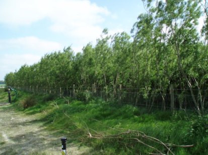
Historically, floodplains have been exploited for agricultural and urban development, which has increased the exposure of people, property and other infrastructure to floods. Flood risk management therefore focused on measures to protect communities and industry in affected areas. However, flood risk is now addressed on a wider catchment scale so that initiatives in one part of a catchment do not have negative effects further downstream. This catchment based approach is embodied within the EU Floods Directive 2007/60/EC, and in recent years, those responsible for flood management have increasingly looked for solutions that employ techniques which work with natural hydrological and morphological processes, features and characteristics to manage the sources and pathways of flood waters. These techniques are known as natural flood management (NFM) and include the restoration, enhancement and alteration of natural features but exclude traditional flood defence engineering that effectively disrupts these natural processes.

NFM seeks to create efficiency and sustainability in the way the environment is managed by recognising that when land and water are managed together at the catchment scale it is possible to generate whole catchment improvements with multiple benefits.

Almost all NFM techniques aim to slow the flow of water and whilst closely connected, can be broadly categorised as infiltration, conveyance and storage.

Infiltration
Land use changes such as set-aside, switching arable to grassland or restricted hillside cropping, can improve infiltration and increase water retention. In addition, direct drilling, ‘no-till’ techniques and cross slope ploughing can have a similar effect. These land use techniques are designed to reduce the soil compaction which increases run-off. Livestock practices such as lower stocking rates and shorter grazing seasons can also help. Field drainage can be designed to increase storage and reduce impermeability, which is also aided by low ground pressure vehicles. The planting of shrubs and trees also helps infiltration and retention by generating a demand for soil moisture, so that soils have a greater capacity to absorb water. Plants also help to bind soil particles, resulting in less erosion – the cause of fertility loss and sedimentation in streams and rivers.

Conveyance
Ditches and moorland grips can be blocked to reduce conveyance, and river profiles can be restored to slow the flow. In the past, peats and bogs have been drained to increase cropping areas, but this damages peatlands and reduces their capacity to retain water and store carbon. The restoration of peatland therefore relies on techniques to restore moisture levels. Pumping and drainage regimes can be modified, and landowners can create strategically positioned hedges, shelter belts and buffer strips to reduce water conveyance.

Storage
Rivers can be reconnected with restored floodplains and river re-profiling, leaky dams, channel works and riparian improvements can all contribute to improved storage capability. In urban areas permeable surfaces and underground storage can be implemented, and washlands and retention ponds can be created in all areas. As mentioned above, the re-wetting of peatland and bogs helps to increase storage capacity.

Many of the effects of NFM might be achieved with the re-introduction of beavers, which build dams that reduce peak flows, create pools and saturate soil above their dams. The dams also help to remove pollutants such as phosphates. Beavers do not eat fish, instead preferring aquatic plants, grasses and shrubs during the summer and woody plants in winter. Beavers are now being introduced in a number of areas in trials to determine their value in the implementation of NFM. One of the key benefits offered by beavers is their ability to quickly repair and rebuild dams that are damaged during extreme weather. However, whilst the potential benefits of beavers are well known, several groups have expressed concern with the prospect of their widespread introduction. For example, farmers and landowners may find increased areas of waterlogged land due to blocked drainage channels. In addition, dams present a threat to migratory fish such as salmon and sea trout.

Beavers are native to Britain and used to be widespread, but they were hunted to extinction during the 17th century. However, other non-native species such as signal crayfish can have a detrimental effect on flood protection because they burrow into river banks causing erosion, bank collapse and sediment pollution. Signal crayfish are bigger, grow faster, reproduce more quickly and tolerate a wider range of conditions than the native white-clawed crayfish. Signal crayfish are also voracious predators, feeding on fish, frogs, invertebrates and plants, and as such can create significant negative ecological effects.

NFM benefits
NFM provides protection for smaller flood events, reduces peak flooding and delays the arrival of the flood peak downstream. However, it does not mitigate the risk from extreme flood events. Effective flood management strategy therefore tends to combine NFM with hard engineering measures. Nevertheless, NFM generally provides a broader spectrum of other benefits.

The creation of new woodlands and wetlands produces biodiverse habitats with greater flood storage capacity. They also enable more species to move between habitats. NFM measures that reduce soil erosion, run-off and sedimentation also help to improve water quality and thereby also improve habitats. In particular, these measures lower nutrient and sediment loading lower in the catchment; two issues which can have dramatic effects on water quality and amenity.

Land use and land management measures help to reduce the loss of topsoil and nutrients. This improves agricultural productivity and lowers the cost of fertilizers. Furthermore, a wide range of grants are available for NFM measures, such as the creation of green spaces and floodplains, to make them more financially attractive to farmers and landowners.

Many NFM measures help in the fight against climate change. For example, wetlands and woodlands are effective at storing carbon and removing carbon dioxide from the atmosphere. Measures that reduce surface run off and soil erosion, such as contour cultivation, can also reduce carbon loss from soil.

Monitoring NFM
Given the wide range of potential NFM benefits outlined above, the number and type of parameters to be monitored are likely to be equally diverse. Baseline data is essential if the impacts of implemented measures are to be assessed, but this may not always be deliverable. For example, it may only be possible to collect one season of data prior to a five year project. However, it may be possible to secure baseline data from other parties. In all instances data should of course be accurate, reliable, relevant and comparable.

Monitoring data should be used to inform the design of NFMs. For example, a detailed understanding of the ecology, geomorphology, hydrology and meteorology of the entire catchment will help to ensure that the correct measures are chosen. These measures should be selected in partnership with all stakeholders, and ongoing monitoring should provide visibility of the effects of NFM measures. Typically stakeholders will include funders, project partners, local communities, landowners, regulators and local authorities.

Since NFM measures are designed to benefit an entire catchment, it is important that monitoring is also catchment-wide. However, this is likely to be a large area so there will be financial implications, particularly for work that is labour-intensive. Consequently, it will be necessary to prioritise monitoring tasks and to deploy remote, automatic technology wherever it is cost-effective.

OTT ecoN with wiper

OTT ecoN Sensor

Clearly, key parameters such as rainfall, groundwater level, river level and surface water quality should be monitored continuously in multiple locations if the benefits of NFM are to be measured effectively. It is fortunate therefore that all of these measurements can be taken continuously 24/7 by instruments that can be left to monitor in remote locations without a requirement for frequent visits to calibrate, service or change power supplies. As a business OTT Hydromet has been focused on the development of this capability for many years, developing sensors that are sufficiently rugged to operate in potentially aggressive environments, data loggers with enormous capacity but with very low power requirement, and advanced communications technologies so that field data can be instantly viewed by all stakeholders.

Recent developments in data management have led to the development of web-enabled data management solutions such as Hydromet Cloud, which, via a website and App, delivers the backend infrastructure to receive, decode, process, display and store measurement data from nearly any remote hydromet monitoring station or sensor via a cloud-based data hosting platform. As a consequence, alarms can be raised automatically, which facilitates integration with hard engineering flood control measures. Hydromet Cloud also provides access to both current and historic measurement data, enabling stakeholders to view the status of an entire catchment on one screen.

Holme Fen – a monitoring lesson from the 1850s

Holme Fen post HS

Holme Fen post

Surrounded by prime agricultural land to the south of Peterborough (Cambridgeshire,GB) , the fens originally contained many shallow lakes, of which Whittlesey Mere was the largest, covering around 750 hectares in the summer and around twice that in the winter. Fed by the River Nene, the mere was very shallow and was the last of the ‘great meres’ to be drained and thereby converted to cultivatable land.

Led by William Wells, a group of local landowners funded and arranged the drainage project, which involved the development of a newly invented steam powered centrifugal pump which was capable of raising over 100 tons of water per minute by 2 or 3 feet. A new main drain was constructed to take water to the Wash. Conscious of the likely shrinking effect of drainage on the peaty soil, Wells instigated the burial of a measurement post, which was anchored in the Oxford Clay bedrock and cut off at the soil surface. In 1851 the original timber post was replaced by a cast iron column which is believed to have come from the Crystal Palace in London.

By installing a measurement post, Wells demonstrated remarkable foresight. As the drainage proceeded, the ground level sank considerably; by 1.44 metres in the first 12 years, and by about 3 metres in the first 40 years. Today, around 4 metres of the post is showing above ground, recording the ground subsidence since 1852. The ground level at Holme Post is now 2.75 metres below sea level – the lowest land point in Great Britain.
Several complications have arisen as a result of the drainage. Firstly, there has been a huge impact in local ecology and biodiversity with the loss of a large area of wetland. Also, as the ground level subsided it became less sustainable to pump water up into the main drain.

Holme Fen is now a National Nature Reserve, managed by Natural England, as is the nearby Woodwalton Fen. They are both part of the Great Fen Project, an exciting habitat restoration project, involving several partners, including the local Wildlife Trust, Natural England and the Environment Agency. At Woodwalton, the more frequent extreme weather events that occur because of climate change result in flooding that spills into the reserve. In the past, this was a good example of NFM as the reserve provided a buffer for excess floodwater. However, Great Fen Monitoring and Research Officer Henry Stanier says: “Floodwater increasingly contains high levels of nutrients and silt which can harm the reserve’s ecology, so a holistic, future-proof strategy for the area is necessary.”

Applauding the farsightedness of William Wells, Henry says: “As a conservationist I am often called in to set up monitoring after ecological recovery has begun, rather than during or even before harm has taken place. At the Wildlife Trust, we are therefore following the example provided by Wells, and have a network of monitoring wells in place so that we can monitor the effects of any future changes in land management.

“For example, we are setting up a grant funded project to identify the most appropriate crops for this area; now and in the future, and we are working with OTT to develop a monitoring strategy that will integrate well monitoring with the measurement of nutrients such as phosphate and nitrate in surface waters.”

Summary
Monitoring provides an opportunity to measure the effects of initiatives and mitigation measures. It also enables the identification of trends so that timely measures can be undertaken before challenges become problems, and problems become catastrophes.

Monitoring is an essential component of NFM, helping to define appropriate measures, measure their success, keep stakeholders informed, identify mistakes, raise alarms when necessary, inform adaptive management and help guide future research.

#Environment @OTTHydromet @EnvAgency @friends_earth


High frequency monitoring needed to protect UK rivers!

29/06/2018
Nigel Grimsley from OTT Hydrometry describes relatively new technologies that have overcome traditional barriers to the continuous monitoring of phosphate and nitrate.

The science behind nutrient pollution in rivers is still poorly understood despite the fact that nitrate and phosphate concentrations in Britain’s rivers are mostly unacceptable, although an element of uncertainty exists about what an acceptable level actually is. Key to improving our understanding of the sources and impacts of nutrient pollution is high-resolution monitoring across a broad spectrum of river types.

Background

Green Box Hydro Cycle

Phosphates and nitrates occur naturally in the environment, and are essential nutrients that support the growth of aquatic organisms. However, water resources are under constant pressure from both point and diffuse sources of nutrients. Under certain conditions, such as warm, sunny weather and slow moving water, elevated nutrient concentrations can promote the growth of nuisance phytoplankton causing algal blooms (eurtrophication). These blooms can dramatically affect aquatic ecology in a number of ways. High densities of algal biomass within the water column, or, in extreme cases, blankets of algae on the water surface, prevent light from reaching submerged plants. Also, some algae, and the bacteria that feed on decaying algae, produce toxins. In combination, these two effects can lower dissolved oxygen levels and potentially kill fish and other organisms. In consequence, aquatic ecology is damaged and the water becomes unsuitable for human recreation and more expensive to treat for drinking purposes.

In its State of the Environment report, February 2018, the British Environment Agency said: “Unacceptable levels of phosphorus in over half of English rivers, usually due to sewage effluent and pollution from farm land, chokes wildlife as algal blooms use up their oxygen. Groundwater quality is currently deteriorating. This vital source of drinking water is often heavily polluted with nitrates, mainly from agriculture.”

Good ecological status
The EU Water Framework Directive (WFD) requires Britain to achieve ‘good status’ of all water bodies (including rivers, streams, lakes, estuaries, coastal waters and groundwater) by 2015. However, only 36% of water bodies were classified as ‘good’ or better in 2012. Nutrient water quality standards are set by the Department for Environment, Food & Rural Affairs (DEFRA), so for example, phosphorus water quality standards have been set, and vary according to the alkalinity and height above mean sea level of the river. Interestingly, the standards were initially set in 2009, but in 75% of rivers with clear ecological impacts of nutrient enrichment, the existing standards produced phosphorus classifications of good or even high status, so the phosphorus standards were lowered.

Highlighting the need for better understanding of the relationships between nutrients and ecological status, Dr Mike Bowes from the Centre for Ecology & Hydrology has published research, with others, in which the effects of varying soluble reactive phosphate (SRP) concentrations on periphyton growth rate (mixture of algae and microbes that typically cover submerged surfaces) where determined in 9 different rivers from around Britain. In all of these experiments, significantly increasing SRP concentrations in the river water for sustained periods (usually c. 9 days) did not increase periphyton growth rate or biomass. This indicates that in most rivers, phosphorus concentrations are in excess, and therefore the process of eutrophication (typified by excessive algal blooms and loss of macrophytes – aquatic plants) is not necessarily caused by intermittent increases in SRP.

Clearly, more research is necessary to more fully understand the effects of nutrient enrichment, and the causes of algal blooms.

Upstream challenge
Headwater streams represent more than 70% of the streams and rivers in Britain, however, because of their number, location and the lack of regulatory requirement for continuous monitoring, headwater streams are rarely monitored for nutrient status. Traditional monitoring of upland streams has relied on either manual sampling or the collection of samples from automatic samplers. Nevertheless, research has shown that upland streams are less impaired by nutrient pollution than lowland rivers, but because of their size and limited dilution capacity they are more susceptible to nutrient impairment.

References
• Bowes, M. J., Gozzard, E., Johnson, A. C., Scarlett, P. M., Roberts, C., Read, D. S., et al. (2012a). Spatial and temporal changes in chlorophyll-a concentrations in the River Thames basin, UK: are phosphorus concentrations beginning to limit phytoplankton biomass? Sci. Total Environ. 426, 45–55. doi: 10.1016/j.scitotenv. 2012.02.056
• Bowes, M. J., Ings, N. L., McCall, S. J., Warwick, A., Barrett, C., Wickham, H. D., et al. (2012b). Nutrient and light limitation of periphyton in the River Thames: implications for catchment management. Sci. Total Environ. 434, 201–212. doi: 10.1016/j.scitotenv.2011.09.082
• Dodds, W. K., Smith, V. H., and Lohman, K. (2002). Nitrogen and phosphorus relationships to benthic algal biomass in temperate streams. Can. J. Fish. Aquat Sci. 59, 865–874. doi: 10.1139/f02-063
• McCall, S. J., Bowes, M. J., Warnaars, T. A., Hale, M. S., Smith, J. T., Warwick, A., et al. (2014). Impacts of phosphorus and nitrogen enrichment on periphyton accrual in the River Rede, Northumberland, UK. Inland Waters 4, 121–132. doi: 10.5268/IW-4.2.692
• McCall, S. J., Hale, M. S., Smith, J. T., Read, D. S., and Bowes, M. J. (2017). Impacts of phosphorus concentration and light intensity on river periphyton biomass and community structure. Hydrobiologia 792, 315–330. doi: 10.1007/s10750-016-3067-1

Monitoring technology
Sampling for laboratory analysis can be a costly and time-consuming activity, particularly at upland streams in remote locations with difficult access. In addition, spot sampling reveals nutrient levels at a specific moment in time, and therefore risks missing concentration spikes. Continuous monitoring is therefore generally preferred, but in the past this has been difficult to achieve with the technology available because of its requirement for frequent re-calibration and mains power.

High resolution SRP monitoring has been made possible in almost any location with the launch by OTT Hydromet of the the ‘HydroCycle PO4’ which is a battery-powered wet chemistry analyser for the continuous analysis of SRP. Typically, the HydroCycle PO4 is deployed into the river for monitoring purposes, but recent work by the Environment Agency has deployed it in a flow-through chamber for measuring extracted water.

The HydroCycle PO4 methodology is based on US EPA standard methods, employing pre-mixed, colour coded cartridges for simple reagent replacement in the field. Weighing less than 8kg fully loaded with reagents, it is quick and easy to deploy, even in remote locations. The instrument has an internal data logger with 1 GB capacity, and in combination with telemetry, it provides operators with near real-time access to monitoring data for SRP.

The quality of the instrument’s data is underpinned by QA/QC processing in conjunction with an on-board NIST standard, delivering scientifically defensible results. Engineered to take measurements at high oxygen saturation, and with a large surface area filter for enhanced performance during sediment events, the instrument employs advanced fluidics, that are resistant to the bubbles that can plague wet chemistry sensors.

Environment Agency application
The National Laboratory Service Instrumentation team (NLSI) provides support to all high resolution water quality monitoring activities undertaken across the Agency, underpinning the EA’s statutory responsibilities such as the WFD, the Urban Waste Water Directive and Statutory Surface Water Monitoring Programmes. It also makes a significant contribution to partnership projects such as Demonstration Test Catchments and Catchments Sensitive Farming. Technical Lead Matt Loewenthal says: “We provide the Agency and commercial clients with monitoring systems and associated equipment to meet their precise needs. This includes, of course, nutrient monitoring, which is a major interest for everyone involved with water resources.”

Matt’s team has developed water quality monitoring systems that deliver high resolution remote monitoring with equipment that is quick and easy to deploy. There are two main options. The ‘green box’ is a fully instrumented cabinet that can be installed adjacent to a water resource, drawing water and passing it though a flow-through container with sensors for parameters such as Temperature Dissolved Oxygen, Ammonium, Turbidity, Conductivity pH and Chlorophyll a. Each system is fitted with telemetry so that real-time data is made instantly available to users on the cloud.

Conscious of the need to better understand the role of P in rivers, Matt’s team has integrated a HydroCycle PO4 into its monitoring systems as a development project.
Matt says: “It’s currently the only system that can be integrated with all of our remote monitoring systems. Because it’s portable, and runs on 12 volts, it has been relatively easy to integrate into our modular monitoring and telemetry systems.

“The HydroCycle PO4 measures SRP so if we need to monitor other forms of P, we will use an auto sampler or deploy a mains-powered monitor. However, monitoring SRP is important because this is the form of P that is most readily available to algae and plants.”

Explaining the advantages of high resolution P monitoring, Matt refers to a deployment on the River Dore. “The data shows background levels of 300 µg P/l, rising to 600 µg P/l following heavy rain, indicating high levels of P in run-off.”

Nitrate
Similar to phosphates, excessive nitrate levels can have a significant impact on water quality. In addition, nitrates are highly mobile and can contaminate groundwater, with serious consequences for wells and drinking water treatment. Nitrate concentrations are therefore of major interest to the EA, but traditional monitoring technology has proved inadequate for long-term monitoring because of a frequent recalibration requirement. To address this need, which exists globally, OTT Hydromet developed the SUNA V2, which is an optical nitrate sensor, providing high levels of accuracy and precision in both freshwater and seawater.

The NLSI has evaluated the SUNA V2 in well water and Matt says: “It performed well – we took grab samples for laboratory analysis and the SUNA data matched the lab data perfectly. We are therefore excited about the opportunity this presents to measure nitrate continuously, because this will inform our understanding of nitrate pollution and its sources, as well as the relationship between groundwater and surface water.”

Summary
The new capability for high-resolution monitoring of nutrients such as phosphorus will enable improved understanding of its effects on ecological status, and in turn will inform decisions on what acceptable P concentrations will be for individual rivers. This is vitally important because the cost of removing P from wastewater can be high, so the requirements and discharge limits that are placed on industrial and wastewater companies need to be science based and supported by reliable data. Similarly, nitrate pollution from fertilizer runoff, industrial activities and wastewater discharge, has been difficult to monitor effectively in the past because of the technology limitations. So, as improved monitoring equipment is developed, it will be possible to better understand the sources and effects, and thereby implement effective prevention and mitigation strategies.

@OTTHydrometry @EnvAgency @CEHScienceNews #Water #Environment

Treating wastewater as a resource.

27/09/2016
A number of British landfill operators are turning wastewater into a resource by utilising OTT monitoring and control systems to manage the irrigation of Willow crops (for renewable energy generation) with pre-treated effluent.

Background
Leachate from landfill sites represents a significant potential environmental liability, extending long into the future after a landfill site has closed. Conventional treatment and disposal options involve biological treatment and consented discharge to either the wastewater treatment network or to the environment. Alternatively, effluent may be collected by tanker for treatment and disposal off-site. However, to improve sustainability and broaden the treatment options, work initiated in the 1990s developed an approach that sought to use effluent as a source of nutrients and water for a Short Rotation Coppice (SRC) crop planted upon the restored landfill.

Willows fed on wastewater!

Willows fed on wastewater!

Following the success of early trials, the Environment Agency published a Regulatory Position Statement in 2008, which said: ‘SRC as part of a landfill leachate treatment process… is a technique (that) can be an environmentally acceptable option if managed appropriately.’

Early systems were operated and managed manually but with the addition of OTT sensors, telemetry and control systems, the process was automated to optimise irrigation and maximise both the disposal of effluent and biomass yield.

Willow SRC has become increasingly popular in environmental restoration work, providing a cost-effective material for stabilisation and reclamation of disturbed landscapes, bioremediation and biomass production.

SRC involves the planting of high yielding varieties of willow at a high density, typically 15,000 plants per hectare. The crop can be expected to last for around 30 years, with harvesting taking place every 3-5 years, and yields varying from 8 to 18 tonnes of dry woodchip per hectare per year. Willow grows quickly and has a particularly high demand for water, so it is ideal for the disposal of large volumes of treated effluent. In addition, the high planting density results in the development of a dense root hair system; effectively creating a biological filter for the treatment of organic compounds and the absorption of nutrients and some heavy metals. Soil fauna help to break down the effluents applied to the crop and soil particles control the availability of nutrients to the willow.

Monitoring and control
In early schemes, irrigation was managed manually on a timed basis with irrigation quantities based on external estimates of evapotranspiration. However, increased levels of monitoring and control are now possible. OTT’s Matthew Ellison explains: “The key objective is to supply the crop with an optimised amount of water, whilst minimising the requirement for staff on site. Too much irrigation would cause run-off and too little would under-utilise the treated effluent and result in poor growth conditions which would affect yield and potentially threaten the crop.

Soil moisture sensors

Soil moisture sensors

“An on-site weather station feeds local weather data to the system which uses crop data to predict evapotranspiration that is used to determine irrigation rates. Soil moisture sensors then check that soil moisture status is correct. Other sensors monitor the performance of the system; checking irrigation feed reservoir level, in-pipe pressure and there are sensors to check flow rates from the drip-feed irrigation. This communication capability is made possible with OTT’s Adcon Telemetry radio network.

“Our latest monitoring and control equipment automates the management of the system for unattended operation and staff are only required by exception. This means that the system is able to operate autonomously, delivering regular data reports, and staff are notified by email or text if alarm conditions occur.”

Emphasising the advantages of controlling the entire network, Matthew adds: “This system facilitates the ability to control and synchronise the main pump, and to open and close the valves at each irrigation zone.”

The latest OTT monitoring and control systems include:

  1. Soil moisture sensors
  2. Irrigation tank level sensors
  3. Irrigation function check sensors
  4. Pipe valves and pressure sensors
  5. Automatic weather station (to calculate local evapotranspiration)
  6. Radio telemetry
  7. ADCON Gateway and PC running addVANTAGE software
  8. Internet connectivity for remote log in

Summary
Looking back over a number of SRC projects, Stephen Farrow one of the instigators of this approach in the UK, and now an Independent Consultant says: “When viewed practically, environmentally and commercially, experience has demonstrated the viability of the overall approach.

“It is also clear that process optimisation with relatively low cost investment in OTT’s monitoring and control equipment has significantly added to the support functionality in terms of both operation and regulatory management.’’

OTT’s Matthew Ellison agrees, adding: “SRC clearly offers a sustainable option for effluent treatment, with highly positive effects on carbon footprint and biodiversity.

“In addition to the environmental benefits, process automation has significantly reduced labour requirements and helped to demonstrate compliance with the site-specific requirements of the Environment Agency.”


New monitoring network for Scottish ports!

05/07/2015

Historically, ferry masters operating off the west coast of Scotland would have to sail to a port and on arrival visually assess the weather and tide conditions before deciding whether safe berthing alongside the pier or quayside would be possible. This wastes time and fuel, and can causes immense frustration among passengers, who may see ferries come close to a port, but thereafter depart without berthing when conditions are determined by the ferry Master to be unsafe. These ferries provide a critically important lifeline service to the islands, so the reliability of ferry services is extremely important.

MV_Caledonian_Isles

With multiple sites in island locations, remote access to accurate local data providing live information on tide level and key climatic conditions could facilitate substantial improvements to the service by aiding the Masters to make a more informed decision at an earlier stage in the voyage – in some instances even before departing the previous port or harbour. The berthing of ferries is a highly skilled job, particularly during bad weather, and the decision on whether a specific ferry can safely berth at a specific port is subjective and ultimately can only be taken by the ferry Master.

Following a competitive tendering process Caledonian Maritime Assets Limited (CMAL), which owns many of the ferries, ports and harbours in the region, procured a network of 15 tide and weather stations from instrumentation specialist OTT Hydrometry. The new monitoring equipment provides live data on port conditions to enable the ferry sailing decisions to be made in a timely manner.

CMAL Harbour Master David McHardie says: “OTT installed the first monitoring station in August 2014 and the network is now almost complete with sensors providing data every 1 minute via UHF radio to ‘gateways’ in the ferry offices, which then submit the data via the internet to a central server, which can be remotely accessed by authorised users.

“We have a regulatory requirement to monitor the tide level in our statutory harbours, but this system also provides essential weather information for our ports. In the past, these measurements were taken manually, so the availability of continuous multiparameter data is an enormous improvement – not just in the quality and value of the information, but also in the safety benefits for harbour operations staff, that this provides.”

OTT_Monitoring_Station

OTT Monitoring Station

The safety considerations involved with the berthing of ferries relates not just to passengers and crew but also to the pier hands that assist with mooring operations in a wide variety of often extreme weather conditions. “Mooring operations are inherently high risk activities; handling ropes can become extremely heavy when wet and subject to enormous forces when under strain,” David says. “So, it is important for us to be able to assess the impact of wind, temperature and waves to protect harbour operations staff. Severe weather berthing conditions can also potentially cause damage to ferries and the structures within the ports, so again, detailed data on localised conditions can help prevent accidents and support insurance claims when necessary.”

The availability of live data on port conditions therefore enables the ferry Masters to make better informed decisions at an earlier stage, thereby saving time, fuel and costs. It also means that passengers are provided with earlier warnings of potential ferry cancellation.

Emphasising the growing need for data, David says: “In recent years, severe weather events appear to have become more frequent and they seem to develop faster; for example, since the monitoring network was installed, we have recorded a sudden drop in temperature of 8°C in just 5 minutes at the port of Armadale on the Isle of Skye, and a maximum wind gust of 96 knots at Castlebay on the Isle of Barra. These conditions represent a rapid deterioration of conditions and the monitoring network enables us to respond quickly and effectively.”

Each monitor is located adjacent to the main berthing area on the pier with a lockable GRP control box. The system is comprised of: an OTT radar level sensor; a Lüfft ultrasonic weather monitor measuring wind speed, gust and direction, air temperature and barometric pressure; an Adcon radio unit with back-up batteries and a marine grade antenna. The radar tide level sensor is an OTT RLS, a non-contact sensor employing pulse radar technology with a large 35m measurement range. Both the RLS and the weather sensors, which have no moving parts, have extremely low power consumption, which is vitally important for installations at remote sites. At two locations it was not possible to install a radar sensor so an OTT CBS (bubbler sensor) was installed providing comparable levels of accuracy and reliability.

Robin Guy managed the monitoring network project on behalf of OTT Hydrometry. He says: “We were obviously delighted to be awarded this contract; it’s a good example of the bespoke monitoring systems that we are able to develop, integrating our sensor, datalogging and telemetry technologies to meet customers’ specific needs.

“Before awarding the contract to OTT, David visited four of our existing installations at the Greenock Ocean Terminal near Glasgow to check the reliability of our equipment in demanding conditions. However, in addition to the ruggedness of this equipment, it has also been designed to cope with interruptions to the mains power supply. The monitors are therefore battery powered and data is transferred from the monitors to the port office gateway via low power radio.”

Monitors on end of pier!

Monitors on end of pier!

Now that the CMAL monitoring system is installed, David is looking for ways to leverage the value of the data. For example, radio data transmission works very well over water, so it should be possible to fit the same technology on ferries so that the ferry Masters can access the data directly, instead of having to call the port office for a verbal update. The OTT monitoring network also incorporates an email alert system, and whilst this has not yet been configured, it will be possible in the future for ferry masters to receive email alerts warning them when pre-specified port conditions arise. “We would also like to eventually make the data available to the public as part of an enhanced harbours information system,” David says. “However, when a ferry has berthed, with the monitoring system being located on the pier, the vessel can cause a wind shadow; which means the wind data during that period can be potentially misleading. It has to be remembered that this system remains only an aid to navigation.”

Summarising, Robin Guy says: “This system demonstrates the value of remote monitoring data, but also highlights the importance of low power, rugged, reliable instruments in harsh environments. The modularity of the system is also very important because it enables us to deploy the most appropriate instruments in each individual location.”


Successful trial for new remote Phosphate monitor!

12/12/2014

Researchers at Britain’s Centre for Ecology & Hydrology (CEH) have conducted trials on the river Thames to evaluate a new remote phosphate monitoring technology (Cycle-P) as part of a high-frequency (hourly resolution) monitoring programme that is studying river nutrient concentrations and how they are affected by algal abundance. The monitoring system ran continuously over the summer of 2014, measuring total reactive phosphate levels in the river, day and night, seven days a week.

CEH_ThamesTrial2014

These results have now been compared with manually collected samples that were analysed in a laboratory with the traditional Murphy and Riley spectrophotometric method on unfiltered samples, and Dr Mike Bowes, senior nutrient hydrochemist at CEH, says: “The Cycle-P is working really well; the system operated independently for long periods and produced results that tracked our lab samples closely.”

Most water quality parameters are relatively simple to measure with low-power accurate sensors. However, the measurement of phosphate necessitates colorimetric analysis and this presents a significant challenge in remote locations with difficult access or where mains power is not available. The Cycle PO4 from OTT Hydrometry (known as the Cycle-P) is therefore gathering considerable interest because it is battery powered and able to operate unattended in the field, running over 1,000 tests before a field service is necessary to change the reagents.

The Cycle-P is an in-situ total reactive phosphate analyser that has been designed for operation by non-chemists. Combining microfluidics with state-of-the-art optics to provide high levels of precision and accuracy, the Cycle-P stores results in an onboard logger, but when combined with telemetry, delivers almost real-time data at user-selectable intervals (typically 1 to 4 hours). The quality of the instrument’s data is underpinned by QA/QC processing in conjunction with an on-board NIST standard. The Cycle-P methodology is based on US EPA standard methods, employing pre-mixed onboard colour coded cartridges for simple reagent replacement in the field.

Phosphate is a key nutrient in the maintenance of aquatic animal and plant life. However, it is also considered to be one of the most important pollutants in surface waters. Excessive quantities, through natural accumulation or derived from human activities such as wastewater treatment and agricultural runoff, can stimulate excessive growth of algae – algal blooms. This reduces light for plants and can lead to oxygen depletion, bacterial growth and eutrophication. In addition, some algal blooms produce toxins that are harmful to other organisms. High phosphate concentrations can therefore cause enormous ecological and aesthetic damage to streams, lakes, canals, rivers and oceans.

The River Thames basin is facing growing pressures from rapid population growth, intensive agriculture, climate change and water resource challenges. Researchers are therefore investigating the changes in water chemistry and ecology that are taking place as water quality improvements are implemented under the EU Water Framework Directive. These monitoring activities provide vital scientific evidence that inform future catchment management decisions.

thames_testDr Bowes has been running a Cycle-P in the Thames at Goring in Oxfordshire since 18th March 2014, as part of the CEH Thames Initiative Research Platform . He is head of the Water Quality Processes group, which has a long track record of using phosphorus auto-analysers, and is therefore an ideal person to assess the merits of this new technology. Furthermore, his research interests include: the impact of changing water quality on periphyton and phytoplankton biomass in rivers; nutrient loads to rivers from sewage and agriculture, and the identification of factors that control the timing and magnitude of algal blooms.

Mike has tried a number of phosphate monitoring technologies in the past but has found them to be either too unreliable or power-hungry. “Much of our work involves monitoring rivers in remote sites that do not have mains power, so I was naturally very interested to learn about the Cycle-P,” he explains. “Our research is designed to identify the causes of algal blooms and to understand the factors that trigger both blooms and algal dieback; the ability to monitor phosphate in remote locations is therefore critical to the success of our work, because manual or even automatic sampling for laboratory analysis, incurs significant delays and increases costs.”

“We were very pleased to be able to help with this research,” adds OTT Hydrometry’s Nigel Grimsley. “The impact of phosphates from agricultural run-off and wastewater treatment is one of the major issues affecting surface water quality and reliable continuous monitoring is essential if this issue is to be managed effectively.

“The Cycle-P has already worked extremely well in a variety of international projects, but it was vital for its capabilities to be demonstrated in UK waters, and the CEH Thames Initiative provided an ideal platform to do so. I am grateful to CEH for the opportunity that they have provided and I look forward to reporting feedback from a number of recent further UK installations.”


WFD dictates need for holistic monitoring strategy

17/08/2010

The European Water Framework Directive and recent technological developments are radically changing the ways in which water resources are monitored. Robin Guy, OTT Hydrometry’s Senior Technical Engineer explains.

Background
The European Water Framework Directive (WFD) aims to promote sustainable water use and to protect water resources. This relates to surface and ground water quantity, quality and ecological status and takes into consideration the likely impacts of climate change.

As a result, a holistic approach to the protection of water resources has developed – Integrated Catchment Management (ICM). This aims to protect water resources at source by avoiding diffuse and point source pollution, by minimising incidents of unconstrained flooding and drought, and by enhancing biodiversity.

A catchment is defined as the land area from which all water drains to a single watercourse. Consequently, the management of catchments necessitates a clear understanding of the complex relationships between land, air and water.

New approach to monitoring
In order to be able to meet the objectives of the WFD it has become necessary to adopt a different approach. The complete hydrological cycle for a catchment must be monitored, which means that it is now necessary to monitor precipitation, surface water, groundwater, soil moisture, vegetation levels and other factors such as land use. A need has also arisen to move away from spot measurements to continuous or semi-continuous monitoring.

Robin Guy

OTT Monitoring System

In-situ monitoring
In the past, remote locations have been problematic because of a lack of power and the time and cost associated with site visits. However, technological advances in recent years have resulted in a far greater proportion of monitoring data being collected automatically in the field and transferred remotely; this has coincided with a greater requirement for field data as a result of the WFD.

Low power stand alone dataloggers are able to store many thousands of records without the need for mains power – and where a continuous power supply is required this can often be provided by a solar or wind powered charger.

Communication technology has advanced beyond all recognition in recent years. As a result, a choice of highly effective and reliable wireless communications options exist, most of which are relatively low in cost and power requirement. These include GPRS, SMS, radio and satellite.

Sensor technology has also advanced to support the move to remote monitoring. Sensors are now more accurate, more reliable, less prone to drift and consequently require less frequent service and/or calibration. For example, in 1662 Sir Christopher Wren invented the first tipping bucket raingauge and this technology became the standard methodology throughout the 18th, 19th, and 20th centuries – an astonishing achievement! However, in the early part of the 21st century a new technology emerged to replace Sir Christopher’s which was able to remain accurate during intense rainfall, to require less maintenance and to provide precise data on rainfall intensity. The new device, known as ‘OTT Pluvio’ employs a weighing measuring principle and is able to operate unattended in remote locations for long periods of time.

Many national rainfall monitoring authorities around the world are moving over to the newer technology. However, it is interesting to note that tipping bucket raingauges remain popular in many countries because of a requirement for direct comparability with historical data. Inevitably, under-reading of rainfall during high intensity precipitation will continue where this is the case.

Field water quality
Historically water quality measurements in remote locations have been undertaken with spot measurements using portable instruments and kits or by taking samples to a laboratory for in-depth analysis. However, here too, sensor technology has advanced considerably and it is now possible for multiparameter water quality monitors to log an array of water quality parameters almost continuously for several weeks without any requirement for maintenance or recalibration. Automatic water samplers have also enhanced monitoring capability, by taking water samples at pre-set intervals and storing them for subsequent analysis. The latest samplers can be activated by changes in local preset parameters, for example breeches of flow or level thresholds signifying a major event, thereby enhancing our understanding of water quality changes with variable flow regimes.

Continuous live data
The ability to monitor a catchment continuously means that the pollution prevention and hydrological objectives of the WFD are more easily met. Continuous monitoring enables the rapid detection of point source pollution and provides an opportunity to take remedial action before serious damage occurs. Similarly, if water level or flow data reaches pre-set low or high alarms, it becomes possible to minimise the effects of flooding and drought. The provision of real time data also assists resource management ensuring that underperforming or faulty sites can be targeted and rectified immediately, not only improving data quality but also helping in the continuous drive for efficiencies.

One of the key advantages of continuous monitoring over spot data, is that it records peaks and troughs, providing much greater insight into the cause and effects of changes in a catchment. Continuous long-term data also enables more accurate identification of diffuse pollution.

New communications technologies combined with continuous monitoring also offer important advantages for stakeholders because it is now possible to display ‘live’ data on a website for the benefit of land owners, regulators, planners, developers, local residents etc. This approach was recently adopted at a major housing development in Waterlooville, Hampshire (GB).

The proposed housing scheme included the building of 2550 homes, which would have a large potential effect on local drainage and flooding. However, Sustainable Urban Drainage Systems (SUDS) have been established to try and mitigate against any potential for flooding by creating a network of ponds and swales.  OTT Hydrometry has installed a number of water level, flow and rainfall monitors at the site to provide continuous performance data for all stakeholders. The main objective is to ensure that the development at Waterlooville will not increase the risk of flooding, affect the water quality or harm the ecology of the receiving watercourses. The data is then posted to a live website to achieve community engagement through transparent and open data collection. The developers are endeavouring to show that through the measures they have put in place localised flooding will not only be mitigated but also reduced, where possible.

Studying the effects of land management practices
The new holistic approach to monitoring has been adopted within a British Dept of  Environment, Food & Rural Affairs (DEFRA) funded project on the outskirts of Exmoor National Park, near Bristol, in South West England. The project has been designed to study the effects of different land management practices particularly with respect to flooding and water quality. It is anticipated that the results of this trial will inform future land management and help to develop flood risk models for the area. In addition, the monitoring regime will demonstrate best practice for compliance with the requirements of the WFD.

Penny Anderson Associates (PAA) are managing the project which has established a catchment-wide monitoring network consisting of the latest OTT instruments such as water level monitors, doppler water velocity meters and automatic raingauges. PAA are conducting flow gaugings at selected locations in order to develop site specific ratings, thereby allowing the generation of continuous flow data through the conversion of measured level data. In addition, Exeter University (GB) has installed water samplers that are activated by level sensors and will operate automatically at pre-defined river levels.

The project will showcase different communication methods including GSM and radio. However, satellite communication may be installed at one site for which radio and GSM are not applicable.

Peter Worrall, Technical Director at PAA says, “The establishment of the OTT monitoring network will enable us to establish accurate baseline data so that we can study the effects of agricultural practices such as stocking density and buffer strips.”

Looking forward
The Waterlooville and Exmoor projects are good examples of the new WFD prompted approach to monitoring. However, the new catchment monitoring requirements, coupled with recent technological advances, will result in the generation of much greater volumes of data. It is important to note, therefore, that data will only contribute to the catchment management plan if it is representative and interpreted correctly, so a level of expertise is often necessary when establishing and managing a monitoring network.

See also Regulations drive automation in W&W in Europe published May 2010